Emergency Management

Solution Group

Industry

Infrastructure Management
Health & Life Science

PoC Duration

Iotellect Match

10-20 days
AI powered Low Code IoT/IIoT Platform

Improve coordination and situational awareness by centralizing communication and real-time event flows, enabling faster response times and better resource allocation. Enhance public safety through timely alerts, support data-driven decisions with analytics, and provide comprehensive reporting for compliance. Use simulations to improve preparedness and optimize workflows.

Iotellect is a low code IoT/IIoT development platform. It does not work as an out-of-the-box solution or product. Instead, it helps you to monetize your IoT know-how by dramatically lowering labor costs and cutting time-to-market for your product, service, or solution. It allows business-oriented IoT professionals to join the development process by converting their IoT market knowledge directly into product features and specific value delivered to your end customers.

Build Your IoT Application

Connect Your

Emergency Management Devices

image
Emergency notification systems
image
Drones and UAV control systems
image
Digital signage panels
image
Structural integrity monitoring equipment
image
Environment and weather sensors
image
First responder wearables
image
Connected rescue equipment
image
Portable medical equipment
image
Radio communication equipment
image
Satellite and mobile communication equipment
image
Surveillance cameras and video analytics systems
image
Emergency vehicle trackers
image
Mobile generators and backup power units
  • Support for communication across various channels, including radio, cellular networks, satellite, and internet-based messaging, ensuring continuous connectivity even when some networks are down
  • Facilitation of seamless integration with other emergency response systems (such as police dispatch, GIS, weather systems, and traffic management), allowing for coordinated efforts across different agencies and departments
  • Usage of GPS and geofencing to track the location of responders and assets, allowing for better resource management and ensuring personnel safety
  • Allocation of bandwidth and prioritizing of network traffic for critical communications, ensuring that emergency messages and data get through even when networks are congested
  • Connection with public alert systems (e.g., text alerts, social media, digital signage) to disseminate information quickly to the community

Connectivity and Management

  • Low code integration with Geographic Information Systems (GIS)
  • Low code integration with traffic management platforms
  • Low code integration with Building Management Systems (BMS) for holistic building control
  • Low code integration with digital twin platform
  • Low code integration with Public Safety Answering Points (PSAPs)
  • Low code integration with weather monitoring systems
  • Low code integration with public alert and notification systems
  • Low code integration with Healthcare Information Systems (HIS)
  • Low code integration with Incident Management Systems (IMS)
  • Low code integration with supply chain and logistics systems

Integration

  • Identification of patterns and trends in incident data, helping to predict the likelihood of future events and improve preparedness and response strategies
  • Monitoring of the deployment and usage of resources, such as personnel, equipment, and supplies, to optimize their allocation and ensure efficiency during emergencies
  • Usage of historical data and machine learning algorithms to predict the impact of potential disasters and assess risks, enabling proactive planning and response
  • Compilation of data from past incidents to analyze response effectiveness, identify strengths and weaknesses, and refine future emergency management strategies
  • Analysis of social media posts and public sentiment to gauge community needs, assess the spread of misinformation, and tailor communication strategies
  • Simulation of various emergency scenarios to analyze potential impacts and response outcomes, helping to prepare for different situations and improve decision-making
  • Monitoring of the health and safety data of responders, such as exposure to hazards or physiological stress levels, to ensure their well-being and adjust operations accordingly
  • Tracking of environmental data, such as air quality, radiation, or chemical spills, to assess public health risks and guide emergency response actions
  • Evaluation of the reach and effectiveness of emergency communications, helping to refine messaging and distribution strategies for future incidents

Analytics

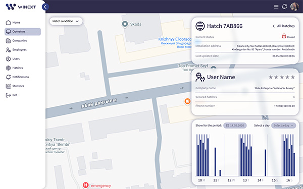
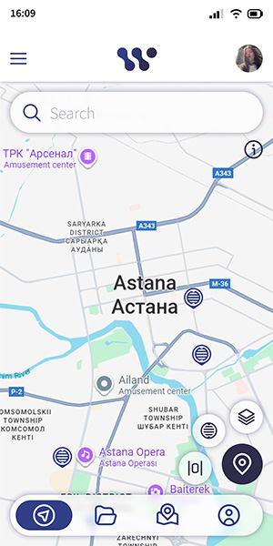
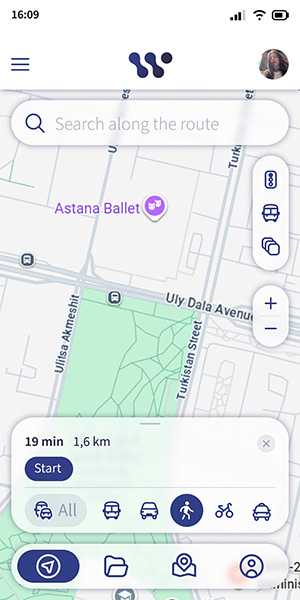
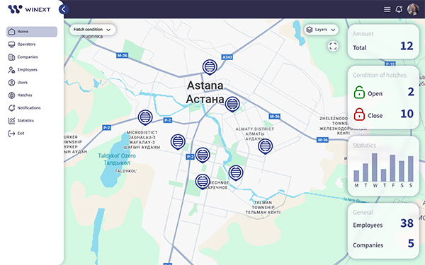
  • Usage of dynamic, interactive maps to show incident locations, resource deployment, and other geospatial data, allowing users to visualize and analyze the situation spatially
  • Tailored viewing of different types of emergencies (e.g., natural disasters, fires, hazardous material spills) with preset widgets and data points relevant to each incident type
  • Heat mapping of density and movement of resources such as ambulances, fire trucks, and personnel, helping in strategic deployment
  • Integration of live video streams from drones, CCTV cameras, and body cams directly into the platform for visual assessment of the situation
  • Toggling different layers on a map interface (e.g., weather conditions, road closures, power outages) to get a multi-dimensional view of the emergency
  • Support for real-time tips and guidance based on the current task or selected tool, helping users quickly understand complex functionalities

UI/UX

Key Features
for Your Emergency Management Solution

Customers and Partners

  • System Integrators
  • Independent Software Vendors
  • Large Enterprises
  • Government and Public Sector Agencies

Solution Users and Developers

  • Farming specialists
  • IoT/IIoT hardware developers
  • Emergency management experts
  • IT professionals
  • Citizen developers
Customer success team
Community
Online training

Assistance